

Need the live air quality index AQI map now today in Colorado Springs Colorado? At VentOwl.com, we make it faster and clearer to check real-time AQI Colorado Springs conditions — so you can see what is happening right now and understand what it means before you head outside.
Colorado Springs sits at over 6,000 feet elevation, and that altitude plays a real role in how quickly ozone forms on warm, sunny days. Combined with regional traffic, military activity, and the broader Front Range pollution load, the Colorado Springs air quality index can shift meaningfully between morning and afternoon. We don’t just surface the number — we help you make sense of it.
The Air Quality Index runs from 0 to 500. Lower values mean cleaner air. Higher values signal conditions that can affect your health, especially for sensitive groups. Whether you’re checking the Colorado Springs AQI today before a run, a commute, or outdoor work, this page gives you what you need to decide quickly and confidently.
TL;DR Quick Answers
Live Air Quality Index AQI Map Now Today in Colorado Springs Colorado
The live air quality index AQI map now today in Colorado Springs Colorado shows real-time ozone and particulate matter conditions across El Paso County — updated hourly from official EPA monitoring stations.
Why it matters:
- Colorado Springs ranks 23rd worst in the U.S. for ozone pollution.
- Ozone peaks in the late morning to early afternoon on warm, sunny days — especially at high altitude.
- Wildfire smoke can shift PM2.5 conditions quickly during fire season.
VentOwl’s take:
- A single AQI number tells you what is happening.
- Context tells you what to do about it.
- Checking live conditions before outdoor activity is the decision that matters most.
Top Takeaways
The most important things to know about Colorado Springs air quality:
- Colorado Springs has a documented ozone problem. The city ranks 23rd worst in the U.S. for ozone pollution. El Paso County earns a failing grade — averaging 10 unhealthy ozone days per year.
- Elevation makes ozone worse here. At over 6,000 feet, stronger UV radiation accelerates ozone formation. Conditions that would stay moderate at lower altitudes can reach Unhealthy for Sensitive Groups ranges by early afternoon on warm days.
- Real-time AQI data changes decisions. The Colorado Springs AQI today can look very different from the Colorado Springs AQI this afternoon. Morning is typically the safest window for outdoor activity. Midday to early afternoon is when ozone peaks.
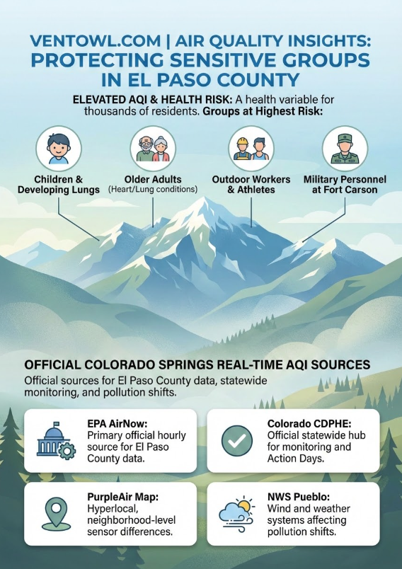
- Sensitive groups face the highest risk. Children, older adults, people with asthma, COPD, or heart conditions, pregnant people, and outdoor workers should check El Paso County air quality before extended outdoor exposure — not after they are already outside.
- Wildfire smoke can shift conditions quickly. Particulate matter in Colorado Springs is generally manageable on most days. But fire season can bring sudden PM2.5 spikes that change the picture with little warning. The AirNow Fire and Smoke Map is the resource to check when smoke is in the region.
Table of Contents
What the Colorado Springs Air Quality Index Means Right Now
The Colorado Springs air quality index measures how clean or polluted the outdoor air is at any given moment. It tracks key pollutants — primarily ozone and particulate matter — against EPA health thresholds and translates those levels into a single, color-coded number.
Colorado Springs has a well-documented ozone problem. At 6,035 feet, the city receives more intense UV radiation than lower-altitude cities, which accelerates the chemical reactions that produce ground-level ozone. When traffic emissions and regional pollution mix with that solar intensity on a warm afternoon, Colorado Springs ozone levels can climb into the Unhealthy for Sensitive Groups range with little warning.
Colorado Springs air pollution levels are not uniform throughout the day. Ozone typically builds from mid-morning and peaks in the early afternoon during warmer months — May through September being the most active period. Wind shifts coming off Pikes Peak, temperature inversions in the Front Range basin, and wildfire smoke from surrounding states can all change conditions rapidly. That is why checking live air quality Colorado Springs data — not yesterday’s readings — matters most.
Particulate matter in Colorado Springs is a secondary concern on most days, but that changes during wildfire smoke events. Fine particles (PM2.5) from fires can penetrate deeply into the lungs and move through gaps in building envelopes, making it harder to escape even indoors. Checking the AQI map Colorado Springs CO in real time tells you whether ozone or particulates are driving conditions today and how severe those levels actually are.
Who Should Pay Closest Attention to El Paso County Air Quality
El Paso County air quality affects everyone, but some groups face greater health risk from elevated ozone and PM2.5 exposure.
Pay closest attention if you are:
- A child or teenager, whose developing lungs are more vulnerable to ozone damage
- An older adult, especially with any existing heart or lung condition
- Someone managing asthma, COPD, or cardiovascular disease
- A pregnant person — ozone and particle pollution are linked to preterm birth and low birth weight
- An outdoor worker, runner, cyclist, or anyone spending extended time outside
- Military personnel training outdoors at Fort Carson or surrounding installations
The higher the AQI, the shorter the safe window for outdoor activity — especially for these groups. Checking the Colorado Springs air quality forecast before leaving the house is one of the simplest protective steps available.
How AQI Conditions Change Throughout the Day in Colorado Springs
Real-time AQI Colorado Springs tracking matters more here than in many cities because conditions can shift hour to hour.
- Morning (6–10 AM): Ozone levels are typically at their lowest. Generally the best window for outdoor activity.
- Midday to early afternoon (11 AM–3 PM): Ozone builds as sunlight intensifies. This is when Colorado Springs ozone levels most commonly reach elevated ranges, making a clean filter for air conditioner units more important for people who spend time indoors..
- Late afternoon (3–6 PM): Wind patterns from Pikes Peak can either disperse or concentrate pollution depending on direction and speed.
- Evening and overnight: Ozone drops. However, particulate matter from wildfire smoke can linger or increase after dark during fire season.
Managing these swings with smart HVAC maintenance is just as relevant in Colorado Springs as it is in places like Miami-Dade County, FL.
Temperature inversions — warm air trapping cooler, polluted air close to the surface — can lock pollution in place overnight and into the next morning. The Colorado Springs air quality forecast from CDPHE and AirNow is the most reliable way to anticipate these shifts before they happen.
In some homes, upgrading systems through HVAC replacement can improve indoor comfort during these events, whether you’re in Colorado Springs or Pembroke Pines, FL.
“In our experience tracking air quality across Front Range cities, Colorado Springs stands out because elevation and ozone interact in ways that can catch residents off guard — conditions that look clear in the morning can shift to unhealthy levels by early afternoon during warmer months, and that timing matters most for the people who are outside when it happens.”
7 Essential Resources
What is Colorado Springs’s official AQI right now, is ozone or particulate matter driving current conditions, is wildfire smoke a factor today, what should sensitive groups do, and what weather conditions could shift the air later today? These are the sources we trust to answer those questions.
EPA AirNow – Colorado Springs Air Quality
The primary official real-time AQI source covering Colorado Springs and El Paso County. Tracks ozone and PM2.5 against EPA health thresholds and updates hourly. The most reliable starting point for checking Colorado Springs AQI today.
Colorado CDPHE – Air Quality Summary
The official statewide monitoring hub from the Colorado Department of Public Health and Environment. Covers Action Days, ozone summaries, particulate data, regional forecasts, and Colorado Springs-specific air quality conditions.
CDPHE – Air Quality Forecasts and Advisories
Best source for checking whether an Action Day is currently in effect for El Paso County. Action Days signal that current or forecasted conditions are expected to reach Unhealthy or Unhealthy for Sensitive Groups on the AQI scale — and trigger mandatory pollution controls like open burning bans.
The most valuable resource during wildfire smoke events. Combines current particle pollution levels, active fire locations across the region, and smoke plume forecasts. Essential from late spring through fall when Colorado wildfires can push PM2.5 into hazardous ranges across El Paso County.
El Paso County Public Health – Air Quality
The local public health authority for Colorado Springs and surrounding communities. Administers air quality complaints, open burn permits, and construction dust permits under a contract with CDPHE. Useful for localized El Paso County air quality guidance and reporting.
Best for hyperlocal, neighborhood-level PM2.5 differences across Colorado Springs. PurpleAir’s private sensor network updates frequently and can surface localized hotspots before regulatory monitors capture them. Most useful when read alongside official AQI sources, which carry greater accuracy for health interpretation.
National Weather Service – Pueblo, CO (Colorado Springs Forecast)
The NWS Pueblo office covers Colorado Springs and El Paso County. Wind speed and direction, temperature inversions, and incoming weather systems all directly affect how air quality conditions develop through the day. Check this alongside AQI data to anticipate what may change in the hours ahead.
3 Supporting Statistics
At VentOwl, live AQI data is most useful when grounded in verified local monitoring data, long-term trend research, and real health evidence. Here are three statistics that explain why tracking Colorado Springs air quality index conditions in real time matters.
1. Colorado Springs ranks 23rd worst in the U.S. for ozone pollution. El Paso County averages 10 unhealthy ozone days per year and receives a failing grade from the American Lung Association. That ranking placed Colorado Springs among the top 25 most ozone-polluted metro areas in the nation — a level of exposure that carries documented health consequences for residents and visitors alike.
Source: American Lung Association, State of the Air 2025
2. Colorado’s oil and gas industry emits roughly 15.6 million tons of pollution annually. With more than 53,000 active wells, processing facilities, storage infrastructure, and pipelines operating across the state, Colorado’s oil and gas sector has emerged as one of the largest regional pollution contributors. That background load contributes to ozone formation across the Front Range — including El Paso County — on days when atmospheric conditions are favorable for accumulation.
Source: IQAir – Colorado Springs Air Quality
3. More than 156 million Americans live in counties that received a failing grade for ozone or particle pollution. The American Lung Association’s 2025 State of the Air report found that nearly half the U.S. population is breathing air that fails basic health standards. Colorado Springs is among those communities — and the health consequences are real: elevated ozone is linked to asthma attacks, heart attacks, strokes, impaired lung development in children, and increased risk of preterm birth.
Source: American Lung Association, State of the Air 2025 – National Press Release
Final Thoughts and Opinion
Colorado Springs has a measurable air quality challenge — not a theoretical one. A top-25 national ranking for ozone pollution and a failing grade from the American Lung Association are not statistics to brush past. They reflect real conditions that affect residents, outdoor workers, athletes, families, and anyone managing a respiratory or cardiovascular condition in this city every day.
The biggest gap we see in how most people approach air quality is treating it as a background concern rather than a daily variable. The Colorado Springs air quality index is not static. It moves with the sun, the wind, the season, and events happening hundreds of miles away. A morning that reads Good on the AQI map Colorado Springs CO can shift to Unhealthy for Sensitive Groups by early afternoon during ozone season — and that difference matters if you are outside when it happens.
VentOwl’s perspective: the value of a live AQI map is not the number itself. It is what the number tells you to do next. Checking live air quality Colorado Springs conditions before outdoor activity is one of the simplest, highest-return decisions available to anyone who lives or spends time in this city. Pairing that habit with regularly changing pleated furnace filters at home helps keep indoor air cleaner on bad AQI days.
The tools exist — from live AQI dashboards to MERV 8 pleated HVAC and AC furnace air filters that support cleaner indoor air when outdoor levels spike. The data is free. Using it is just a habit worth building.
Frequently Asked Questions
Q: What is the Colorado Springs air quality index right now?
A: The Colorado Springs air quality index updates in real time through EPA AirNow and the CDPHE monitoring network. The live AQI map shows current conditions across El Paso County, including the primary pollutant driving that reading — typically ozone during warmer months or PM2.5 during wildfire smoke events. Check the live map linked on this page for today’s current reading.
Q: Why does Colorado Springs have elevated ozone levels compared to many U.S. cities?
A: Colorado Springs sits at 6,035 feet elevation, where more intense UV radiation accelerates the chemical reactions that form ground-level ozone. When vehicle emissions, regional industrial pollution, and that solar intensity combine on a warm, sunny afternoon, Colorado Springs ozone levels can climb quickly. This is why the city ranks among the top 25 most ozone-polluted metros in the country despite being far smaller than cities like Los Angeles or Houston.
Q: When is Colorado Springs air quality typically worst during the day?
A: Ozone tends to be lowest in the early morning and peaks between late morning and early afternoon — roughly 11 AM to 3 PM — on warm, sunny days. This is the window when the Colorado Springs air quality forecast most commonly shows elevated or unhealthy ozone conditions. Sensitive groups often benefit from MERV 11 allergen defense replacement HVAC and AC furnace filters during these hours. Early morning is generally the best time for outdoor exercise or extended outdoor work during ozone season.
Q: What is an Action Day for El Paso County air quality?
A: An Action Day issued by CDPHE means current or forecasted air quality is expected to reach Unhealthy or Unhealthy for Sensitive Groups on the AQI scale. During ozone Action Days, open burning is prohibited. Sensitive groups are advised to limit outdoor activity. Check the CDPHE advisories page for current El Paso County status.
Q: How does wildfire smoke affect particulate matter in Colorado Springs?
A: On most days, particulate matter in Colorado Springs is relatively manageable — El Paso County receives a passing grade for year-round PM2.5 levels. But during wildfire season, smoke from fires across Colorado and neighboring states can drive PM2.5 into Unhealthy or Very Unhealthy ranges rapidly. Fine particles in smoke are small enough to penetrate building gaps, making it difficult to fully escape exposure indoors. The AirNow Fire and Smoke Map is the best tool for monitoring smoke-driven PM2.5 events.
Q: Who should be most cautious about real-time AQI conditions in Colorado Springs?
A: Children, older adults, people with asthma, COPD, or cardiovascular disease, pregnant people, outdoor workers, runners, cyclists, and military personnel training outdoors at Fort Carson face the highest risk from elevated Colorado Springs air pollution levels. The higher the AQI, the shorter the recommended window for outdoor exposure — especially for these groups.
Q: How does VentOwl help me use Colorado Springs AQI data more effectively?
A: VentOwl adds the context that raw AQI tools leave out — explaining why Colorado Springs sees elevated ozone at altitude, how conditions shift throughout the day, who is most affected, and what current conditions mean for real outdoor decisions. We connect the live map to the practical insight that helps you act on the data, not just read it.
Track Live AQI Map in Colorado Springs Colorado Today – Air Quality Now
Colorado Springs ranks among the most ozone-polluted cities in the United States — and conditions can shift from safe to unhealthy before midday. Check the live Colorado Springs AQI map now and know the air you’re breathing before you head outside today.